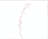
When doing GIS analysis, we definitely don't rely on one software to do the analysis. However, the difference in file extensions from one software to another causes us to be able to export / import the data we work with. Some software may be able to easily import data, but not infrequently there is also GIS processing software that has to do tricks and steps in order to continue the analysis. When you find this method, errors often occur and you can't even display the data it should. Therefore I will help explain how to import AutoCad data. The data I use is a river image from the field. This data will be processed and displayed in ArcGIS software. Some conditions that must be met before importing data are that unique symbols are not allowed (for example: ! @ # $ % ^ & * ( ) , . ). Use the symbol ( _ ) to replace the dashed space, make sure it is adjusted to the local projection (if not, you can georeferencing vector data using spatial adjustment). Here are the steps that must be taken to convert autocad data to arcgis:
- Open your ArcGIS and on the “standard” tab select the ArcCatalog icon
- Then a storage directory window will appear, then right click on the data you want to import in ArcGIS, select Export > To Shapefile (Multiple)
- In the output folder, replace the directory in the folder you want to save (try not to be too deep for storage because it will be an error)
- In the ArcCatalog window, refresh it and the imported shp will appear. If you want to retrieve river data, cross and tie points, you can add a shp line to the workspace
I will give an example if we want to retrieve river data on the shp line
- First right click on shp and click on Open Attribute Table.
- Select (select) the name on the table layer "RIVER" (EVERY SHAPEFILE HAS A DIFFERENT TABLE ATTRIBUTE NAME)
- After that right click on the shp line > Select Data > Export Data
- As usual don't save too deep for storage directory,
- Then the result will be like this, (The above steps can be done to retrieve data other than rivers).


