

Cutting the map is often needed for the analysis or presentation of data in a smaller area than the original data. For example, to make a map of a certain village. While the shapefile(.shp) map that I have is a map of one province. So in a condition like this, I have to cut the .shp/map based on the boundaries of the village where the map will be made.
ArcGIS software provides tools for users to perform cutting needs such as the above conditions. In ArcGIS tools to perform Clips. The first thing that must be seen when you want to do t is to make sure each map has the same Datum Coordinates so that it can be overlaid as shown below.


- Open arcmap
- Add shapefile data. For example I use Land Use data (to be cut) and Village Administrative Boundaries (to cut)
- Open ArcToolbox. This can be done by clicking the ArcToolbox icon or clicking the Geoprocessing menu > ArcToolbox.


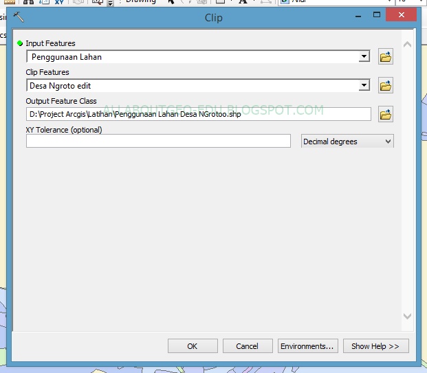
- The Input Features column is used for the layer to be cut. Clip Features, used as a cutter, Output Feature Class to store the data from the cuts. For the rest, leave the settings at their defaults and when they are set as shown below, click OK.

- After the process is successful, the cutting data will automatically appear on the work screen. This will be the result of the cut.

Don't forget to comment and share because it's a form of appreciation that we need to be more eager to write


)